"Twenty years from now you will be more disappointed by the things that you didn't do than by the ones you did do. So throw off the bowlines. Sail away from the safe harbor. Catch the trade winds in your sails. Explore. Dream. Discover". Mark Twain

Friday, November 24, 2006

Arizona / New Mexico

Arizona / New Mexico
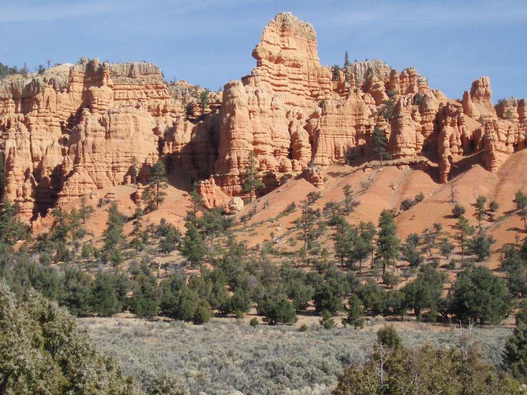
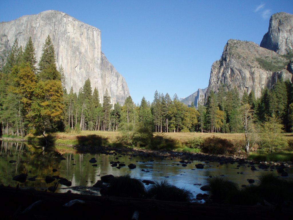
I continued the Grand Circle tour from Four Corners heading west towards Arizona's Grand Canyon. The ride along Highway 160 would take me through the Navajo Nation's Land which covers about 27,000 square miles (70,000 square KM) occupying all of Northeaster Arizona and extending into Utah and New Mexico. It is the largest land area assigned primarily to a Native American jurisdiction within the USA .
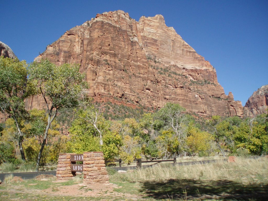
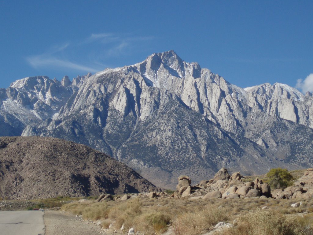
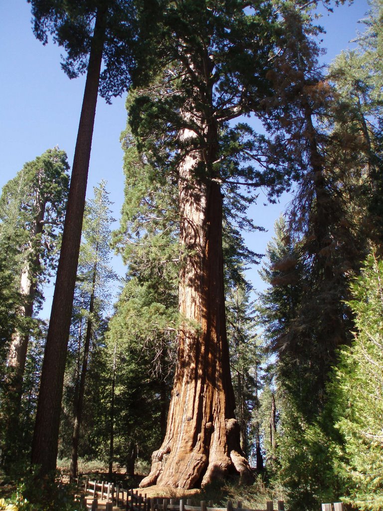
I would spend a day in Grand Canyon National Park – a spectacular setting it is.. To allow tourists to view portions of the Canyon a road has been constructed along the Canyon's Southern Rim. There are designated viewing areas with limited vehicle parking spaces. Although this was the first week of November traffic in this park was noticeable higher then that in any of the previous parks I have visited. Some jockeying was required to advance to the edge of the observation areas for quality viewing. I spoke with a Park Attendant who indicated that during the peak tourist season it is not unusual to have row upon row of tourist standing along the observation areas.
Following my tour of the Canyon I stopped to view the Imax Movie “The Grand Canyon”. I am a fan of IMax movies and this one did not disappoint. Perhaps there was more Hollywood in this film then required however the feeling of being totally immersed in the film as a helicopter flies through the canyon was exhilarating.. Following the film I located a Helicopter Tour group and purchased a seat on a flight scheduled for the following morning. At 09:00 five other individuals and I were weighed (weighting was required to determine seating arrangement) and provided a orientation on helicopter passenger safety. We were then marched off to an awaiting helicopter and strapped into our seats. What a treat this ride turned out to be. It was well worth the admission fees. I love flyng in helicopters especially over areas as spectacular as that of the Grand Canyon. Learn more about these helicopter tours www.papillon.com Sadly all of my photo's of the the Grand Canyon have either been deleted or filed somewhere in the system. At this time I can not retrieve them.
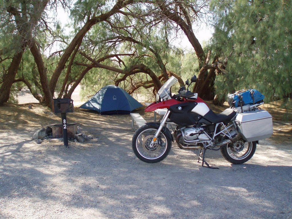
I then moved on to the city of Flagstaff where I would take a break and remain stationary for five days to enjoy some R & R. During an afternoon stroll though this community's historic downtown I spotted a sharp looking adventure motorcycle a Triumph Tiger. As I walked over to inspect this moto an adventure GS pulls up and parks next to the Triumph. This was how I met Dave and Andy a couple of very resourceful adventure riders. Over coffee they shared stories of their travels through Mexico. They told me about “The Flying Dorffini” a great motorcycle shop where I had my oil and filter replaced at 35,000 KM. I was invited to join them and some of their buddies for a Saturday evening BBQ followed by a movie projected on Matt's large screen entertainment center. The movie we viewed was “Mondo Enduro” a film about a bunch of Brits riding around the world on 350cc motorcycle. A very entertaining evening it was.. That night I was invited to stay over at Dave and Karen's house an offer I did not pass up.

On Monday morning of November 13th I once again meet-up with Dave, Andy and Scott and together we rode off to Albuquerque. A most enjoyable ride it was. We were off to the BMW dealer in Albuquerque to attend a presentation by Glenn Heggstad - the striking viking www.strikingviking.net an adventure motorcyclist who has rode to some of the world's most remote regions. A very informative and entertaining presentation it was. Sadly the following morning it was time to say goodbye as my buddies return to Flagstaff. Special thanks to these individuals for being very kind to this vagabond.
While in Albuquerque I was invited to Randy's house for dinner. Randy a resident of this area rides a BMW R-1200-RT. I met him one morning in Flagstaff where he had stopped for coffee on one of his rides. It was great to be provided with a home cooked meal. Although Randy's home is in New Mexico he is a very accomplished boater having navigated all of the coastal waters of western and eastern USA. Between boats and motorcycles we had much to talk about.
On recommendation by Randy and Andy I would set out to ride a scenic route north of Albuquerque through the communities of Jemez Spring, Los Alamos, Espanola, Taos, Las Vegas and Santa Fe.. The scenery through this area was beautiful and some of the communities provided much interest.
Los Alamos is home to “Los Alamos National Laboratory”. It is one of the largest multidisciplinary institutions in the world. Among other types of classified research which is undertaken here work towards the design of nuclear weapons is ongoing. Road work was underway in this community c/w the installation of a number of security checkpoint areas ie boarder like crossing kiosks.
Taos - When I rode into this community I knew I would have to stay for 3 or 4 days in this region. It is a small town with a strong Native, Spanish and American presents and a great location for some R and R. This region contains the Native community of Taos Pueblo which has been continuously inhabited for more than 1000 years. It's most prominent architectural feature is a multi-storied residential complex of reddish-brown adobe built between 1000 and 1450 A.D. This facility has been designated a National Historic Landmark and a World Heritage Site.

From Santa Fe I would ride south to Fort Sumner where I would learn about the exploits of Bill the Kid. By the age of 21 he could be linked to the death of 12 men - On July 14, 1881 the young outlaw was killed by sheriff Pat Garrett. Billy the Kid has grow into perhaps the most famous and symbolic figure of the American old west.

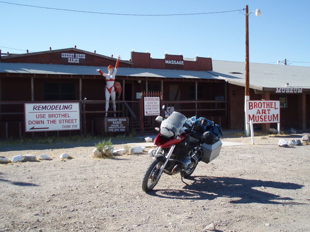
I then moved on to the city of Roswell which is famous for the “Roswell UFO incident”. This event involved the recovery of crash materials near this community in July 1947. This incident has since become the subject of intense speculation and research. There are varying views on what actually happened. The US military maintains that what was recovered was a top-secret research balloon which had crashed. However many UFO researchers believe the wreckage was that of a crashed alien space ship and that the military covered up the space ship recovery. For some Roswell is synonymous with UFOs and likely ranks as the most famous alleged UFO incident.

I rode from Roswell heading west up over the Capitan and the Vera Cruz Mountains. Through the Valley of Fire State Park - an area which contains miles of buckled twisted lava which is part of an extensive flow from several volcanoes. Pass the Trinity Site - the location of the worlds first Atomic bomb explosion - a barren land of grassy prairie and sandy desert. Continuing west to the City of Socorro where I would stop for a few days during the Thanksgiving break and wait for the weekend's traffic to subside. It was in this community where I was provided with a pleasant surprise. The local grocery store carried Moosehead Lager beer. A beer which is brewed and bottled in St. John, New Brunswick. I did purchase a box of this produce to provide a little taste of home. The interesting point was - the cost of this beer in New Mexico was $10.34 ($11.86 cdn). If I were to purchase this product in the same community where it is brewed and bottled it would cost over $18.00 cdn – Go Figure!!!

Over a number of days I would ride west from Socorro along highway 60 to the National Radio Astronomy Observatory - one of the world's premier astronomical radio observatories. I would spend a couple of hours touring this very interesting facility. Learn more about this facility www.vla.nrao.edu

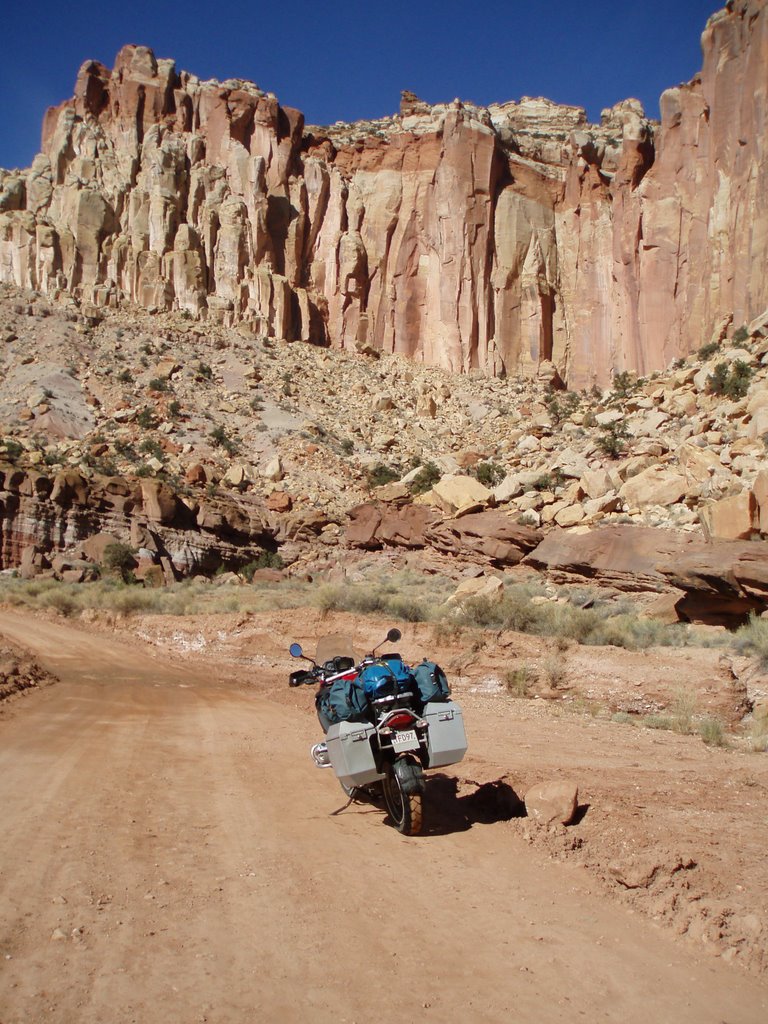
Onward along highway 12 and 180 through the Gila National Forest known for it's scenery ranging from high mountains with Aspen and Douglas fir to warm prairie like semi-arid lowlands. In Silver City I met Bob a biker from Alabama who was heading to Las Vegas. Over dinner Bob suggested a very scenic ride east along highway 152 through the Mimbres mountains.

The following morning under sunny skies I located the mountain pass and was treated to a spectacular ride with plenty of ups / downs and tight chase your-tail-turns. I then headed south on route 27 to city of Las Cruces. A community which claims to have superb year-round weather with 350 days of sunshine. This days ride was terminated in El Paso, Texas. A large city of 600,000. As I rode into this city the Marty Robin's tune was rolling around in my head “Out in the west Texas town of El Paso I fell in love with a Mexican girl”.

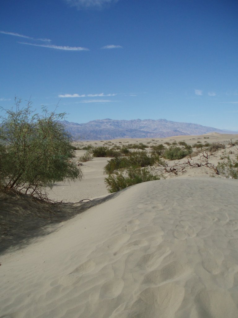
On an e-mail recommendation from number one son Daryl - I rode north to White Sands National Monument. A gigantic sea of sparkling white gypsum. This park cover an area of 300 square miles (777 square KM) of glistening white sand with it's wave like dunes. Engulfed within these elements felt like I have been transposed to snow fields of the far north. This visit provided an interesting experience – my perception / sensory information tells me this white stuff should be snow but yet it isn't – amazing our Mother Nature is..

The region near the city of Alamogordo has a significant military presence. The nearby Holloman Air Force Base is home to the Stealth F117A Nighthawk aircraft. An alternate landing strip for the space shuttles is also located here. The White Sands Missile Range - a test area of 3200 square mile (8300 square KM) is located near by. The community is also home to the New Mexico Museum of Space History – a very interesting tour this facility provided.

It was in the City of Alamogordo where I experienced the first precipitation in eight weeks. Fortunately I had booked into the motel by the time the rain commenced. The storm although short in duration was extremely intense. The following morning I rode east to Cloudcroft into Sacramento Mountains. Within a hour of my ride I was forced to alter my plans. The precipitation in the mountains came as snow and the road was becoming extremely hazardous. I forced to turn around and retrace my path. With my re-established bearings in a southwesterly direction I terminated this days ride in the town of Demings.

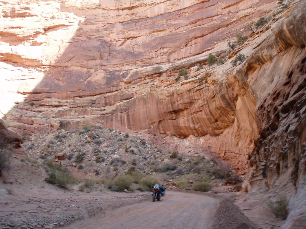
From Demings I headed south towards the Mexican boarded into the small community of Columbus. Turning west I rode the remote and sparsely traveled highway 9. This highway would provide a very scenic ride through a series of remote regions of desert like semi-arid lowlands combined with the mountain crossing over the Cedar Mountain Range, across the continental divide at the Pyramid Mountains and finally across the Peloncillo Mountains into Arizona. The US border patrol personnel were very visible along this ride. I was waved through a number of checkpoint as vehicles were pulled over to be inspected. Considering the number of police officers and marked vehicles I spotted along this ride the moneys dedicated to this activity must be enormous.


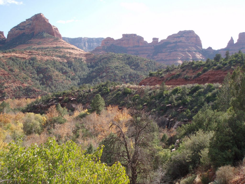
Arizona's Sedona Area


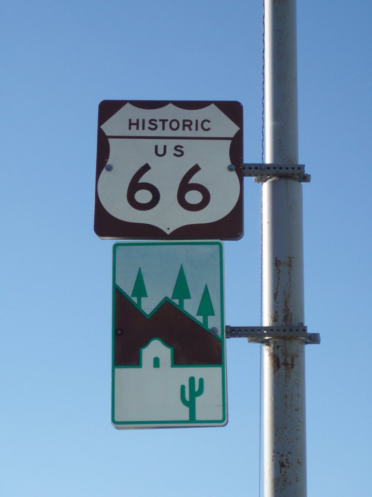
Route 66 - the Main Street of America - the Mother Road - was one of the original federal routes. It originally ran from Chicago through Missouri, Kansas, Oklahoma, Texas, New Mexico, Arizona and California before ending in Los Angeles - a total of 2,448 miles (3,939 km).


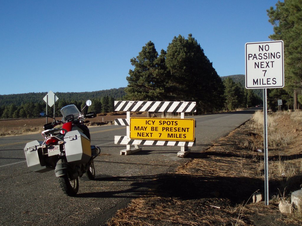
Riding into late November is posing a few problems. I did proceed over the next 7 miles without incident.


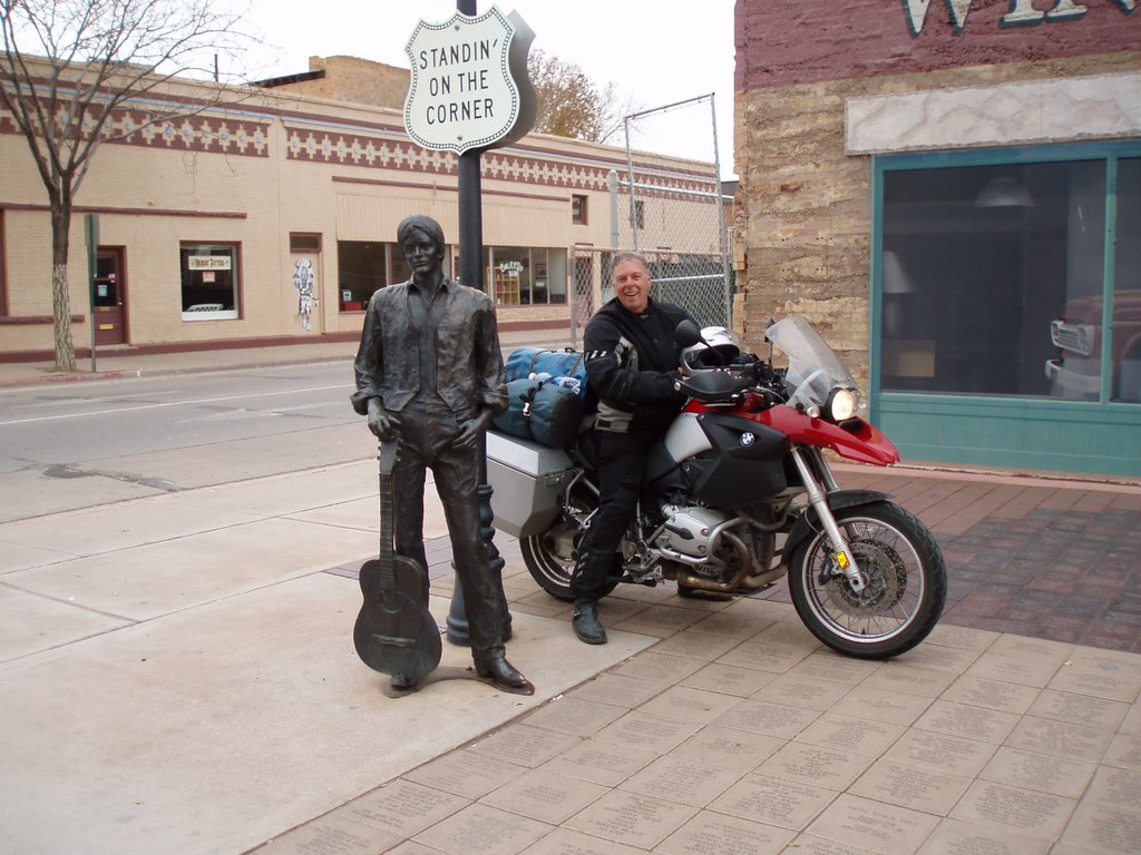
Well I'm a standing on a corner in Winslow Arizona and such a fine sight to see - It's a girl my Lord in a flatbed Ford slowin' down to take a look at me. Man I love those Eagle tunes “Take it Easy”


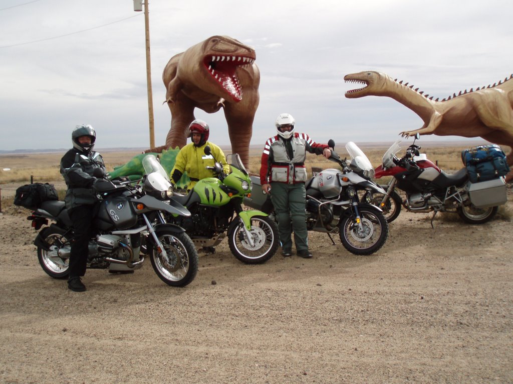
On our ride to Albuquerque we stopped to check out these prehistoric creatures.. Scott, Dave and Andy


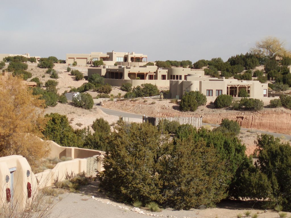
I do like this New Mexican architecture.


I stopped here for lunch in the community of Jemez Springs, New Mexico. A great spot it was.


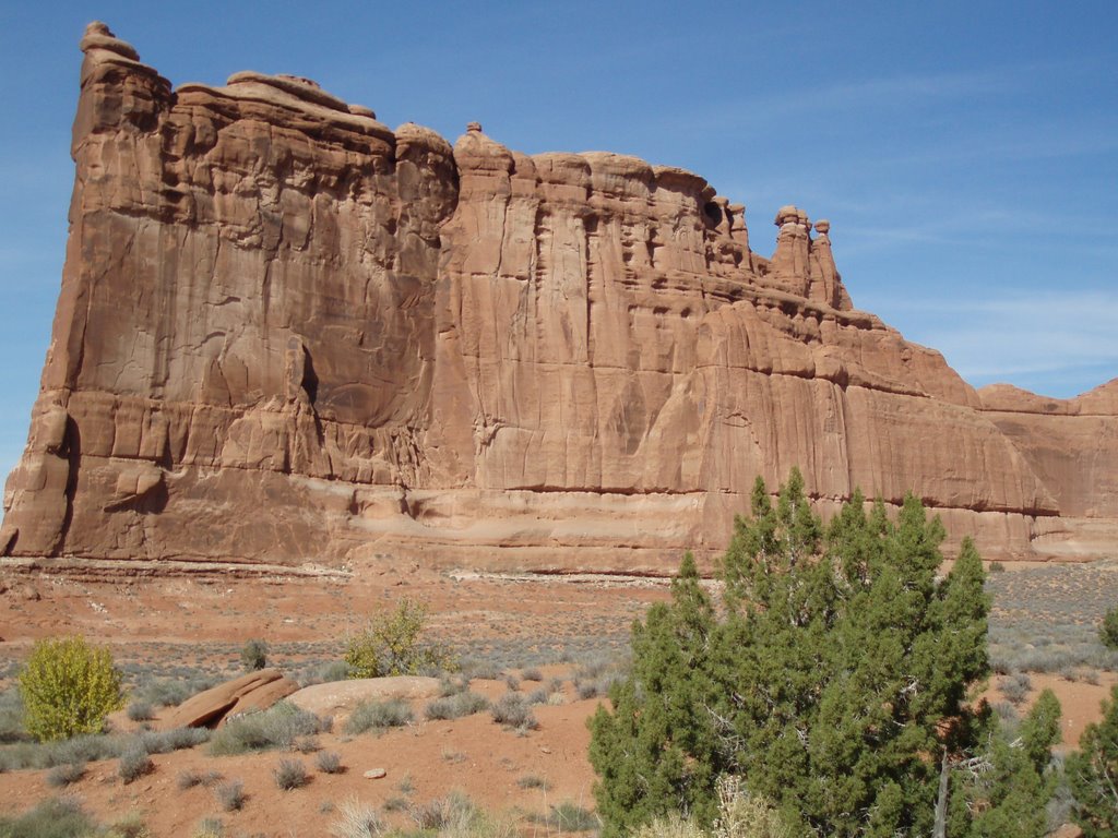
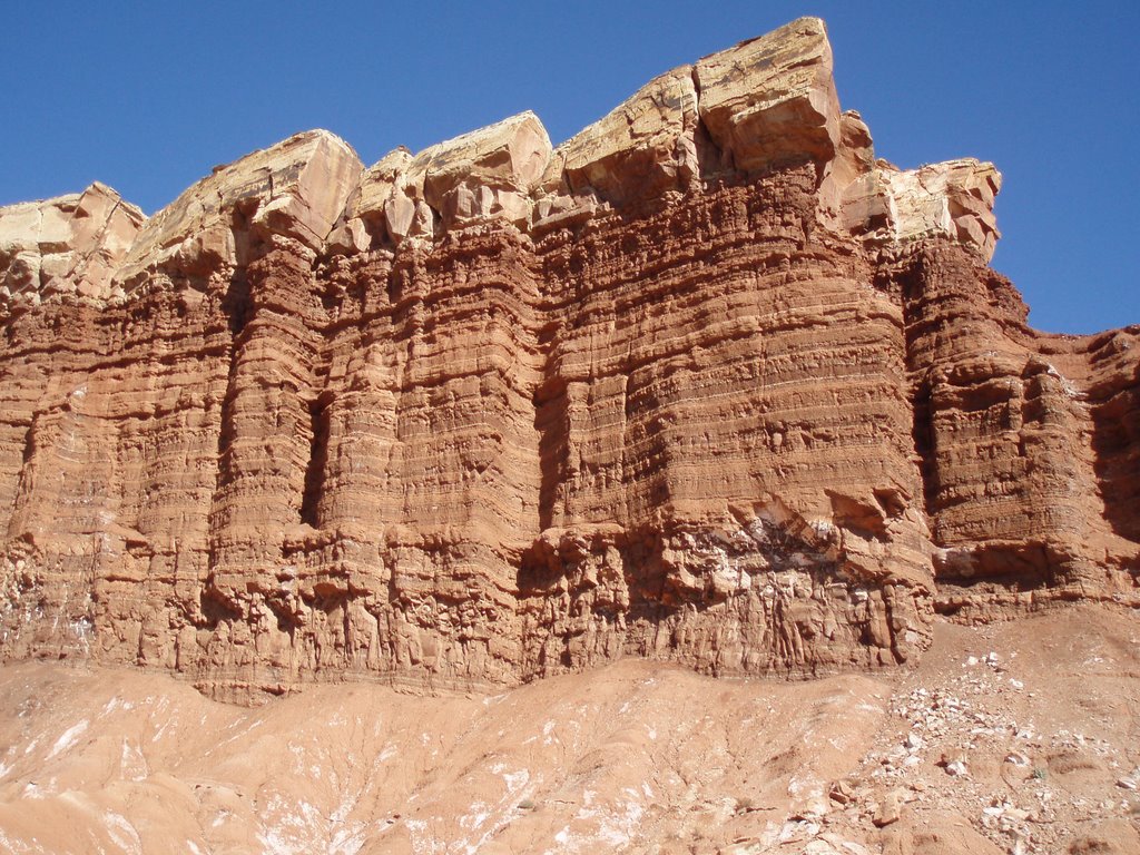
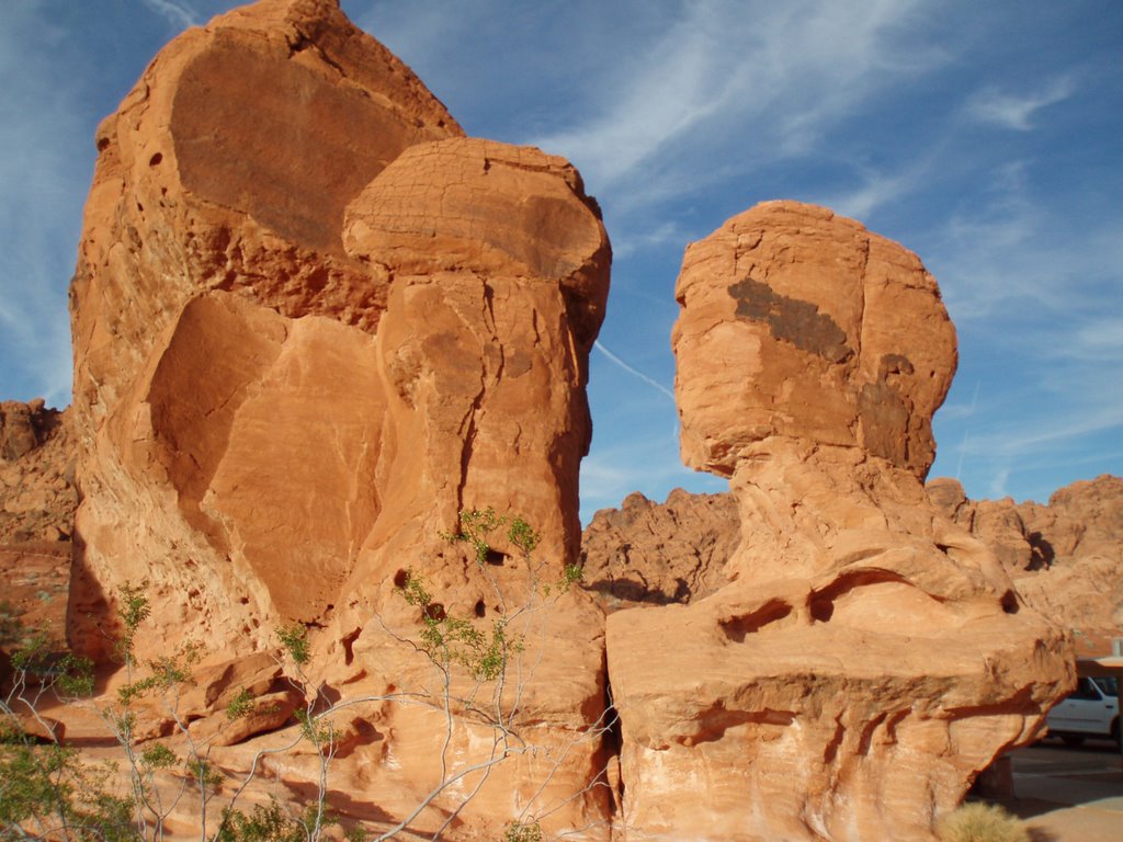
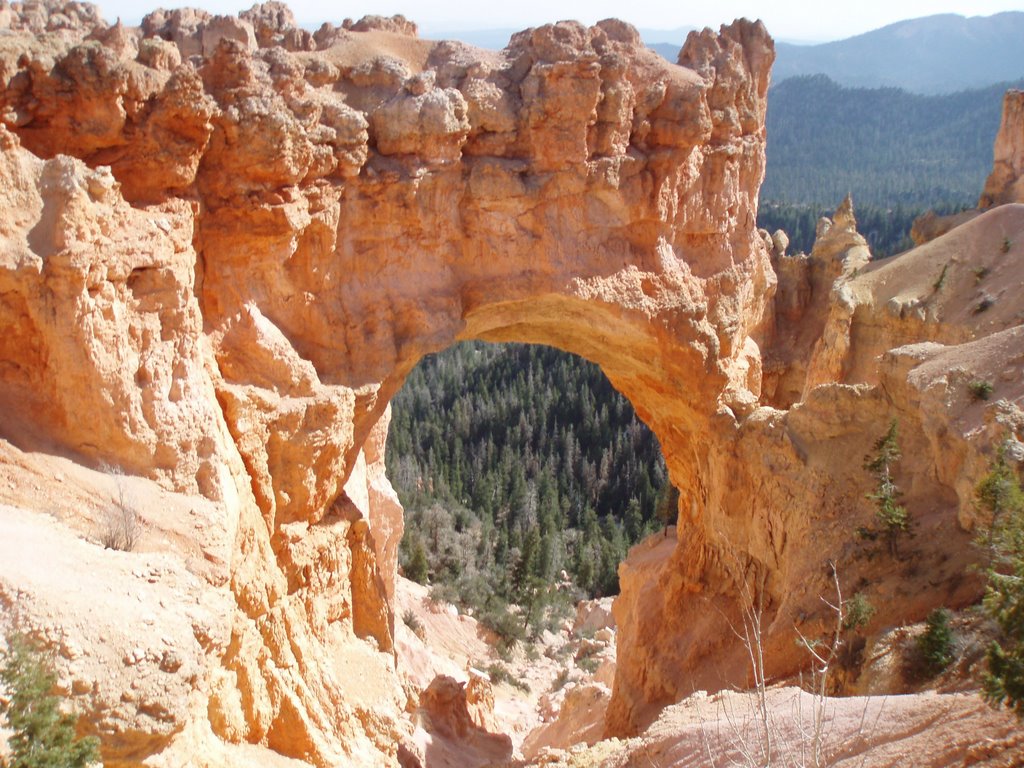
The landscape of Northern New Mexico..


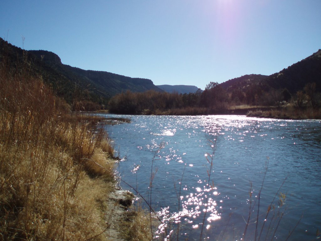
The Rio Grande flows from its headwaters in the San Juan Mountains of southern Colorado for 1,865 miles (4830KM) to the Gulf of Mexico near Brownsville, Texas.


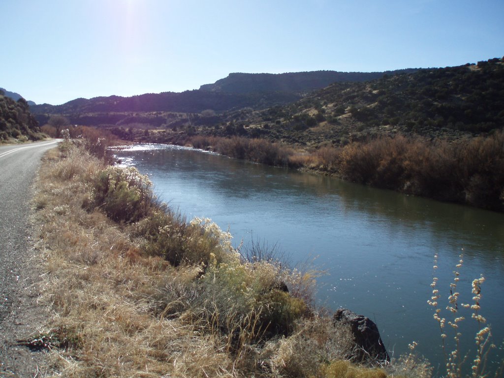
The picturesque Rio Grande.


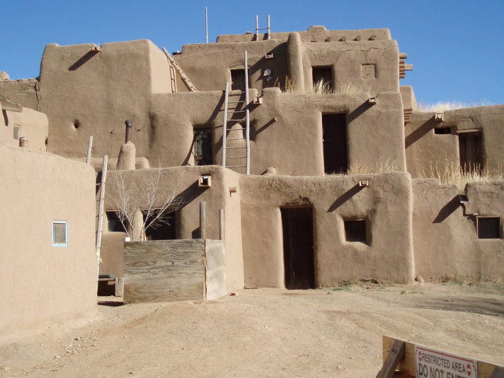
Taos Pueblo has been continuously inhabited for more than 1000 years. This a multi-storied residential complex of reddish-brown adobe (sun-dried brick made of clay and straw) built between 1000 and 1450 A.D. has been designated as a National Historic Landmark and a world heritage site.


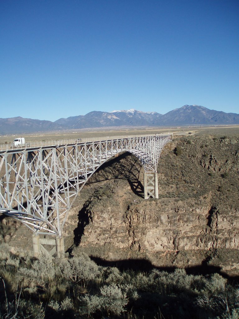
This bridge expands New Mexico's Rio Grande Gorge which is 800 feet (244Metres) deep.


Taos Ski Valley.. This ski resort was open for business within a week of my visit.


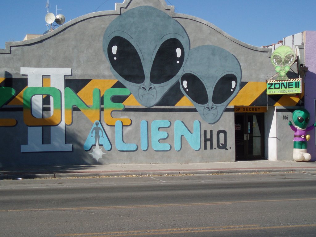
The City of Roswell is synonymous with UFOs and Aliens.


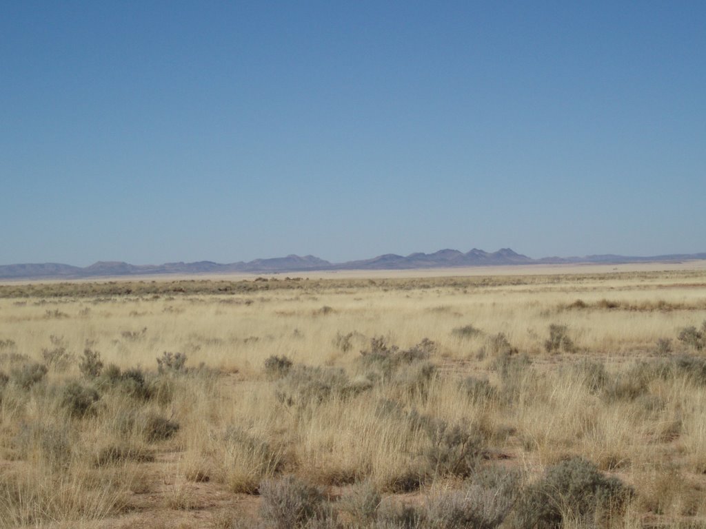
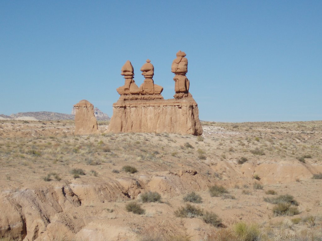
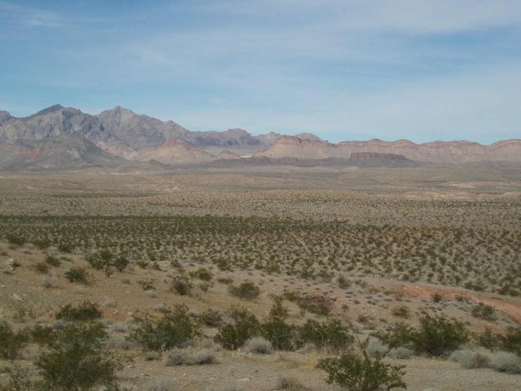
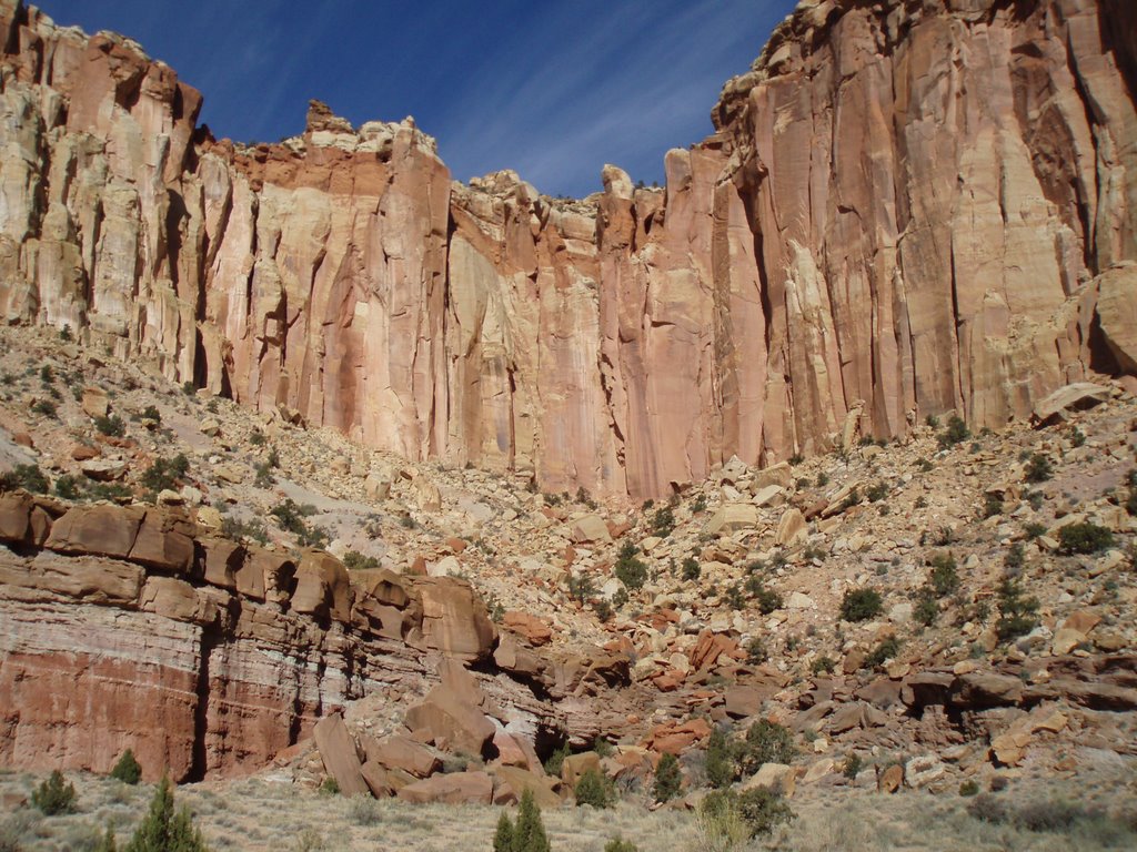
The landscape of southern New Mexico.

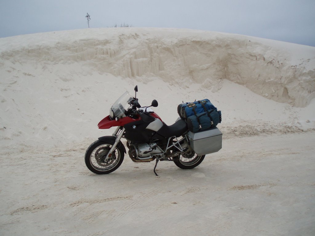
A snow bank or a sand dune?

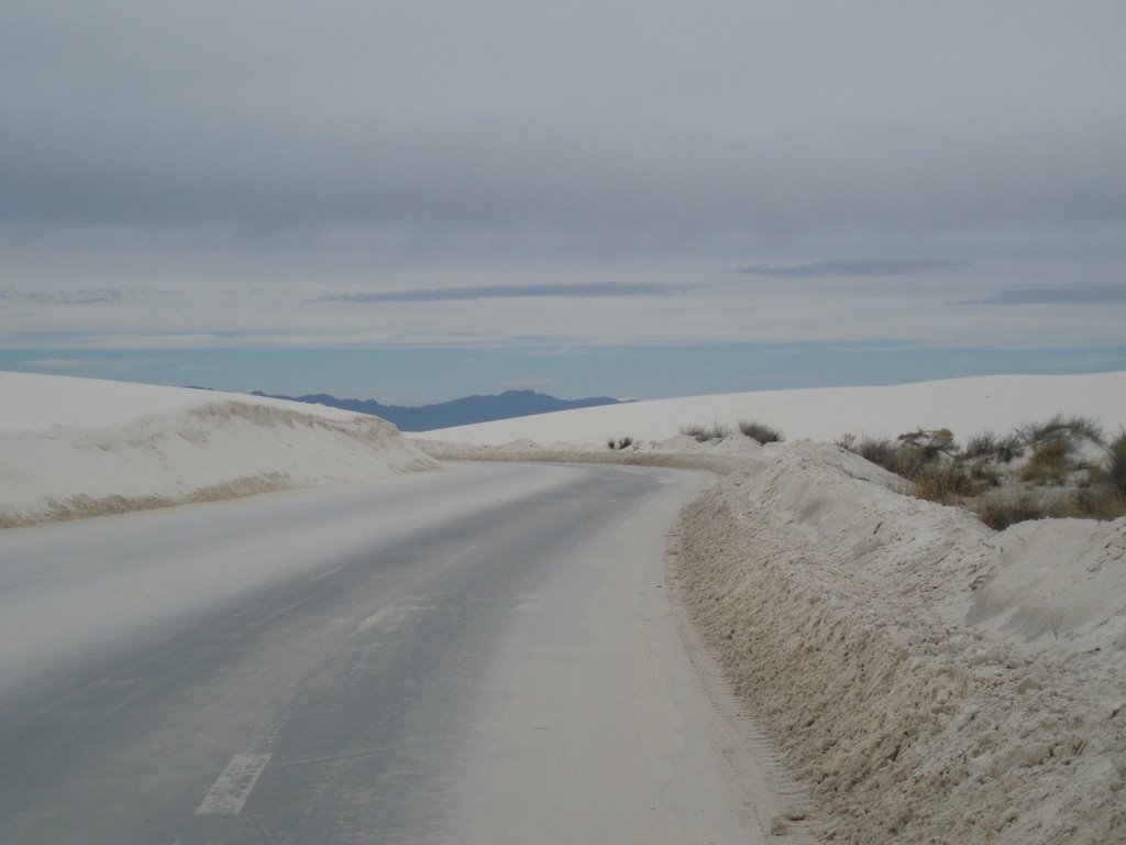
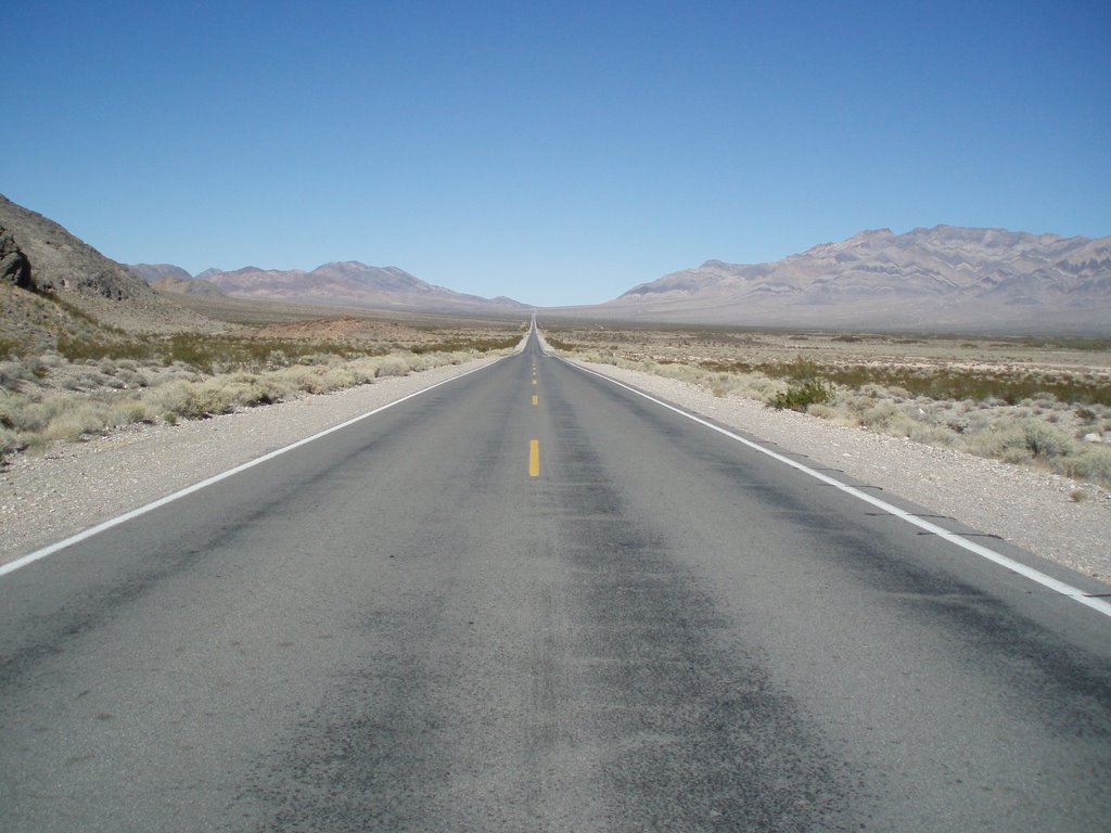
This route through the desert resembles that of a Maritime mid-March road.

Saturday, November 18, 2006

Nevada / Utah

My entry into Nevada was via the lower southwestern portion of the state. As one local put it “ I rode over the hump and into Pahrump, Nevada”. I would spent the night in this city. It was interesting to observe the sights and sounds of this community. Every public establishment – gas bar, grocery stores, coffee shops, restaurants had a designated area for slot machines. Main street was the home for a number of casino's and other establishments which I had never before seen – brothels. That evening I set out to check a couple of casinos – these establishments offer no appeal to me – I found them to be very smokey / noisy and filled with individuals who undoubtedly have more appropriate places to be dropping coins. I moved on. Although the brothels did create much curiosity for me I was not brave enough to walk into these establishments and check them out. I noted billboard advertising a Brothel Art Museum and decided I would check this place out the following morning. I did ride the 25 miles (40KM) out of my way only to find the museum closed. Unfortunately I've learned nothing about this business worthy of passing along to you.

I rode into Las Vegas on a Friday morning thinking I should spend a couple of days in this city. After riding the strip in mid morning traffic I stopped at a couple of budget hotels to find they both were booked for the weekend. That's okay with me I thought I don't really want to stay here anyway. So I rode off into the desert along I-15 until I reached Lake Mead National Recreation Area. Lake Mead is a very large reservoir in the Mohave Desert which was created when Hover Dam was built on the Colorado River. In this desert park I located a camp site and set up shop. Here I would spend the next 2 nights and 3 days exploring the Mohave Desert, Hover Dam and a number of State Parks.

Over a period of two weeks I would ride a spectacular circuit know as the “Grand Circle”. This 1,000 miles (1600 KM) loop would take me through a number of southern Utah's National Parks. A region famous for incredible scenery, red rock pinnacles, unique rock formations and deep canyons. It is a region consisting of Zion, Bryce, Capital Reef, Canyonland and Arches National Parks, Grand Staircase - Escalante National Monuments. All of these Parks are within the Colorado Plateau which make up an immense area of land bordered on the south by the Sonoran Desert and Painted Desert, on the west by the Great Basin of Nevada, on the east by the Rocky Mountains, and on the north by the Uinta Mountains of Utah.


A wordsmith I am not and I do not have the skill to describe the beauty of these National Parks and Monuments so for your viewing pleasure I posted additional photo's - I trust you'll enjoy the view.


In Nevada I stopped to check out this Brothel Art Museum but it was closed and no I did not stop at the brothel down the street.


Bryce National Park
One of the many mountain tunnels.
Bryce National Park
Zion National Park
Zion National Park
Canyonland National Park
Arches National Park

Goblin Valley State Park, Utah.


Arches National Park
Zion National Park

Enclosed within the canyon at Bryce National Park.

Body parts are spread within Utah, Arizona, Colorado and New Mexico at Four Corners. This is the only location in the USA where four States share a common point on their border.

Nevada's Mohave Desert

The Hover Dam is a National Historic Landmark and has been rated by the American Society of Civil Engineers as one of America's Seven Modern Civil Engineering Wonders.


All traffic over the dam had to first proceed through a security check point.


Nevada's Valley of Fire State Park.

Zion National Park
Arches National Park
Zion National Park
Canyonland National Park
Arches National Park

Goblin Valley State Park, Utah


It was a delight to arrive upon this scene. One of the cowboys asked if I wanted to join-in.


An amazing ride down through the canyon.

Saturday, November 04, 2006

Calfornia

Eat, Sleep and Ride.... An awesome 12 days of riding California has provided. I rode in this State on a rainy Sunday afternoon on October 15th making my entry via the North West corner from Oregon. By 6 PM I had settled into the Travel Lodge Motel in the town of Crescent City. The office manager suggested a Chinese Restaurant as one of the possible dinner options. So off I go for a very enjoyable meal c/w fortune cookie with 2 messages one reads “A bold and dashing adventure is in your future within the year”. All right - Now that's good news – That I'd enjoy. The second note stated “You will receive unexpected support over the next week. Accept it graciously”. I'll make reference to this message later in the posting.
Rain continued the following morning with light showers under cloudy skies. I decided I would move on. I stopped at the Redwood Nation Park information center. The Ranger on duty, a biker fan, was very interested in the R-1200-GS and my ride. A very nice chat we had. He suggested I ride a dirt road through the park then connect with a secondary road onto highway 199 which would lead me back into Crescent City. So off I go to find this Jejediah Smith road. What a treat this ride turned out to be on a rainy Monday morning. This mostly single lane road meandered through a forest of huge Redwoods. I encountered 3 SUVs over the length of the ride heading in the opposite direction. It felt like I was out here on my own in this peaceful forest of giant Redwoods. When I reached the end of the road I turned around and rode the same route back into town. Why would I ride on a highway when there is an option to ride a great dirt road. At the end of the ride the GS is covered in mud and looking good again.
By noon the rain became more intense so I decide to remain in Crescent City for another night. I book a room at the Front Street Motel – I was provided a room upstairs and away from the parking lot. I thought I would take the remainder of this rainy day to work on the blog. Although the sign outside the motel stated wireless Internet access - the signal was much too weak thus rendering the system useless. So I settled down and worked off line and caught up on some reading. An easy uneventful afternoon / evening it turned out to be. However, at 1 AM I was awaken by the sound of the anti-thief alarm on my bike. I jumped up out of bed thinking “shit, someone is messing with my bike”. Where am I - where are my pants - where are my boots. Before I could get dressed the alarm reset - thus indicating no further bike movement. I could not see the bike from my room – what should I do? I can't go out and fight with a couple of thugs but I can't let them mess with my bike. I had to go check – I waited a few minutes and went outdoors – there was no one around and the bike remained covered with the tarp. I carried a tarp which I use to cover the bike overnight while parked in these environments – I am assuming someone attempted to remove the tarp from the bike which was on its center stand. Perhaps while leaning on the bike or putting on the tarp it causing the rear wheel to drop a few millimetres and activated the alarm. Whatever had happened the alarm functioned properly and frightened the intruders off. I returned to my bed for a very restless night and a very early morning get away.

I continued riding along the coast of California to the town of Eureka where I would spent the night. The following morning I rode away from a very foggy coastal city and had headed westward into the Coastal Mountains Range through the Shasta-Trinity National Forest to the City of Redding and beyond to Lassen Volcanic National Park. The advantage of touring in mid October is the limited traffic within these remote areas. I experienced a very pleasant ride through Lassen Volcanic National Park. Sunday and Monday's coastal rain had provided a blanket of snow in the elevated regions of this park at 10,457 feet. It was neat to experience this season's first traces of snow. The warmth of the mid October sun had cleared all of the snow from the road thus providing great autumn riding. However, in one area where the water from melting snow had been running across the road during the early afternoon's sunshine was now turning into slush / ice as the sun dropped behind the mountain and the cool air set in. It was scary to come upon this product with very little or no warning. Fortunately the line I selected was ice free and I proceeded without incident. To quote my Alaskan riding buddy John “that experience initiated a 8.5 on the rectum tightening scale.” I noticed a Park Ranger as I rode by a picnic area – I stopped to inquire if I'd experience more of these surprises before I left the park. I was informed that I would have clear sailing as I dropped to the lower elevations – off I go for some easy riding to the community of Red Bluff where I would spend the night.

The ride south through the Sacramento Valley has brought back traces of summer. Not since the days of late August in the Okanagan Valley have I experienced these summer temperatures. The Sacramento Valley is sheltered by the Sierra Nevada's to the east, the Coastal Mountains to the west and the Siskiyou's to the north. This region is lush flat grasslands rich in citrus, nut orchards and large cattle ranches. I selected a number of secondary routes through this scenic valley which provided a very pleasant ride. At Yuba City I located highway 20 and rode west into the mountains to Tahoe National Forest and into the resort communities of Lake Tahoe. A section of highway worthy of comment was a pass over the top of a mountain in the National Forest. This road was barely wide enough for two vehicles – without guard rails and the potential for a drop of 20 metres or more over a very sharp edge – an attention getter indeed and worthy of note. I would spend a day in this region exploring Squaw Valley Ski Resort the home of 1960 Winter Olympics Games, the picturesque town of Lake Tahoe and a ride around the lake's perimeter.

From South Lake Tahoe on a cool bright autumn morning I set out for Yosemite National Park. The ride would take me into Nevada to locate highway 395 - continuing south on this route I would returned to California and ride through the Sierra Nevada Mountains, lush valleys, the Toiyabe National Forest, Mono Lake and finally into Yosemite National Park. This day's ride turned out to be as much about the journey as the destination. A great ride it was and Yosemite is an amazing place. Yosemite National Park is another region worthy of a “WOW” – As I rode into this boxed canyon a granite wall 7 miles long and 1 mile across with near vertical cliffs 3,000 feet high stood before me. One of the cliffs known as El Capitan is 3600 feet and is one of the world largest piece of exposed granite. It was easy to become absorbed in this place and lose track of time. The sun was low in the sky when I left the park and darkness had set in by the time I reached the town of Merced where I booked a room at the Travel Lodge Motel. This being the off-season, motel rates have become competitive and affordable. The town of Merced is located in the San Joaquin Valley and thus maintains extended summer temperatures. For the next two days I would remain in this region – pitch a tent – relax and enjoy the sun's warmth. It was good to be sleeping outdoor again. Although the nights were cool, the morning sun soon restored temperatures to a very comfortable level.

A chat with some of the locals would determine my next destination. My journey over the past months has been very much a laissez-faire (were should I go tomorrow) and it is rare that I'd pass on a recommendation from a local. I broke camp early on a Sunday morning and set out on a recommended route via a series of secondary roads to Kings Canyon National Park and Sequoia National Park. This ride would take me through the interestingly named communities of Catheys Valley, Mariopsa, Ahwahnee, Coarsegold, Fresno and Grants Grove before I would reached Kings Canyon National Park. The highway through this park takes the rider along steep mountain roads with sharp drop-offs. This is a highway of many curves and switchbacks along towering granite cliffs and tumbling waterfalls. An amazing ride this day provided. From King Canyon National Park I rode into the adjacent Sequoia National Park the home of the majestic sequoia trees. Parking the moto and taking a walk through a section known as the giant forest was very inspiring. These living giants soar hundreds of feet into the heavens. In volume of total wood, the giant sequoia stands alone as the largest living thing on Earth. In all the world, sequoias grow naturally only in this region on the west slope of the Sierra Nevada Mountains most often between elevations of 5,000 and 7,000 feet. One of the trees I stopped to admire is designated as the General Sherman tree and is between 2,300 and 2,700 years old. Simply a great day this Sunday has rendered. I rode out of the park returning to the San Joaquin Valley and the community of Three Rivers where I camped for the night.

The following day I rode south through the valley. At lunch time I stopped in the small community of Springville where I located a cafe with a shaded outside deck. There I would enjoy great coffee and a good meal. I chatted with a couple of ladies who stated summers in this region are very hot and sometime unbearable - for 4 days this past July temperatures remained at a scorching 118 degrees(48C). Following lunch I headed west to ride through Sequoia National Forest crossing over the Sierra Nevada Mountains via Sherman Pass. Another memorial ride this turned out to be. However the excitement and rewards associated with riding over this isolated scenic pass were somewhat shadowed by the concern over my limited fuel supply and lack of planning. I completed the days ride in the community of Lone Pine as the fuel warning alarm was activated – thus indicating 80 KM of travel was available with the remaining fuel. I purchased fuel and located a motel room where I would spend the night.

The small community of Lone Pine is located on the eastern slope of the Sierra Nevada Mountains at the base of Mount Whitney (14,494 feet / 4418M) the highest point in the lower 48 states. From this location I would set out for Death Valley National Park. This National Park is a land of extremes. It consist of 3.3 million acres of spectacular desert scenery, rare desert wildlife and complex geology. It contains the lowest, hottest, driest location in North America. Summer temperatures commonly run above 120 degrees Fahrenheit (49C). Death Valley is one of the hottest places on earth, attaining the second-highest temperature ever recorded, 134 degrees F (57). It contains the lowest point in the western hemisphere 282 feet(86M) below sea level near Badwater - the highest point (in the lower 48 states) Mount Whitney just 76 miles (123 km) west. It was incredible to ride through this land. A place with a name so dismal and doomful, an inhospitable and hostile place yet it is a place of much intrigue to this Maritimer. It was an awesome feeling to stretch my legs out over the bike's engine guards, lean back against gear strapped onto the bike and belt out those great Eagle tunes as I rolled along over the desert highway. Singing to my trusty steed “ I get a peaceful, easy feeling and I know you won't let me down 'cause I'm already standing on the ground” and another favorite “On a dark desert highway cool wind in my hair warm smell of coletus rising up through the air up ahead in the distance I saw a shimmering light my head grew heavy and my sight grew dim I had to stop for the night” great tune Hotel California by the Eagles. What a blast this ride was.. I did stop for the night at a place called Furnace Creek where I camped for the next 2 nights and spent 3 days enjoying the autumn desert warmth and learning about this amazing place known as Death Valley.

People I encountered along the way..
I am always impressed with individuals who chose bicycles to travel great distances. I met Mike a Bostonian cycling through Death Valley where we both had stopped to admire a large salt lake. I learned that he had started his journey in Fairbanks Alaska and rode down the Alcan Highway, through the Canadian Rockies in the USA and was on his way to Mexico. I questioned Mike about what it felt like to be pedaling down a highway and see bears grazing in the ditches up ahead.. Not a very good feeling was his response but nothing like having a bear come into your tent. And then he proceeded to tell a story about a bear destroying his tent one night as he lay there but fortunately the panic and hollering frightened the critter off and all that had to be replaced was a tent.. A motorcyclist walked by as I chatted with Mike and spotted my license plated. She enthusiastically question me about my trip.. My reaction was “lady that's nothing - talk to this man” and pointed to Mike – I have much respect for individuals with such courage.

While camping in Death Valley I met Larry and Jill and couple of motorcycle enthusiastic who had trailered their dirt bikes from LA to the desert for a few days off road riding. Larry is also the proud owner of a great looking Red R-1200-GS which he had left at home.. I was invited to join them for dinner one evening – it was great to share good food and exchange biking stories. This couple was very kind to me and for that I am grateful.
I shared lunch with Cleo and Jan, two biker ladies both in their 50s from Utah. They were returning home following a 4.5 months journey through Canada. The objective of their ride was to attempt to get as far north in each province as their cruiser bikes, a Harley and a Yamaha, would allow. A very interesting chat we had. I was extremely impressed with these ladies who rode their bikes c/w street tires across the Trans Labrador Highway. There were many who cautioned them and suggested not to attempt this – but Jan's response “I'll worry about that tomorrow, today we ride”. You gotta love it!!!

I rode into the town of Pahrump, Nevada and stopped at a strip mall to withdraw cash from the local bank. There I met Pat a biker enthusiastic who had expressed interest with the bike and my ride. We chatted for sometime and as the discussion came to a close I asked if there was a campground near by. Pat paused for a moment and stated “Hey I got a garage where this is room to store your bike, I got a spare bedroom you are welcome to have and I've picked up groceries as he pointed to the cart – I'll put something on for supper.” This offer can as a total surprise – I wasn't sure how to respond. So I chose the easy route and passed... now realized that this was a missed opportunity. As I rode off I thought about the fortune cookie and it's message. You will receive unexpected support over the next week. Accept it graciously.


It was an awesome feeling to stretch my legs out over the bikes engine guards, lean back against gear strapped onto the bike and belt out those great Eagle tunes as I rolled along over the desert highway. Singing to my trusty steed “ I get a peaceful, easy feeling and I know you won't let me down 'cause I'm already standing on the ground”


Service didn't appear to very good here so I moved on.


A typical desert scene. The temperature on this October day in Death Valley was a hot 90F (32C) degrees


Sand Dunes of Death Valley


Mount Whitney (14,494 feet / 4418M) the highest point in the lower 48 states is located on the eastern slope of the Sierra Nevada Mountains.


The Joshua Tree is a native to the southwestern states of California, Arizona, Utah and Nevada.


Switchbacks through the Sequoia National Park


Some of the challenges road builders must overcome to provide access to the remote area's of Kings Canyon National Park.


Some come to California to visit San Francisco, Los Angeles or San Diego. Others come explore remote mountain passes.


Sequoias grow naturally only in this region on the west slope of the Sierra Nevada Mountains most often between elevations of 5,000 and 7,000 feet.


The beauty of Yosemite National Park.


Yosemite National Parks - El Capitan is 3600 feet and is one of the world largest piece of exposed granite.


Riding south on highway 395 looking down from mountains at Mono Lake


Lake Tahoe is located in the in Sierra Nevada Mountains at the borders of Calfornia and Nevada.


My Oasis in the desert at Furnace Creek in Death Valley